Category: temporary expert

  • Corporate Bohemia

    Corporate Bohemia

    This is a project that came as a result from my research into cartography as a medium for both art and propaganda for my Temporary Expert class.

    Inspired by all that, I wanted to make a map that has two layers of meaning: one apparent that is mundane and sterile, and another that is hidden and “sinister.”


    WELCOME

    Propaganda, I feel, has to be about a cause, and the only cause that I am remotely passionate against is the corporate system.

    Naturally, I opted to make an interactive map that a fictional corporation has commissioned and placed in one of its floors so that new employees can interactively get familiar with their new habitat.

    BEGIN

    map3

    The user is instructed to click on and only on the colored icons. Upon doing that, labels about the different departments in the floor are displayed.

    map10-hr map9-it map8-finance map7-lobby map6-marketing map5-exit map4-conf

    To me, the language of propaganda is the language of slogans. Its most natural medium is the medium of graphic posters.

    When the user “defies” the obvious instructions by clicking on other, non-highlighted elements on the map, including some of the desks, the conference room’s screen, and the rest rooms, posters are displayed with anti-corporate messages.

    map16-tv map15-sick map14-cheese map13-stationery map12-eye


    I opted to have an eerie piano music piece to accompany the map, and also make the animation of the pieces floaty and slow to communicate a mood of unease.

  • Maps With An Agenda, Research Summary

    Maps With An Agenda, Research Summary

    This is a summary of my final Temporary Expert research project on maps, propaganda, and cartographic art.


    cartopsychosis.002


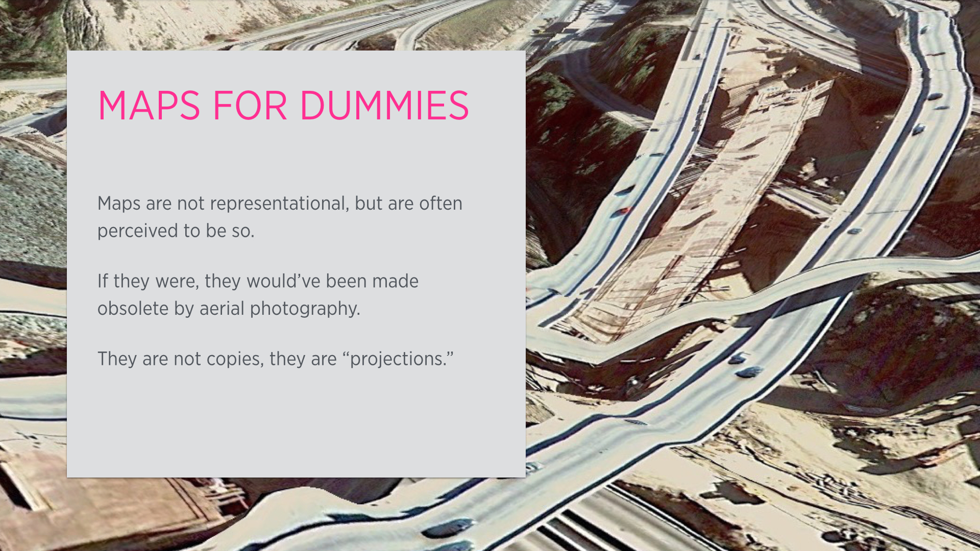
    Not really, but rather, our perception of maps is. Maps are not completely representational, and were never meant to be. They are, by design, incapable to be that: immersion is not part of their design goals. They don’t represent reality but are used to communicate usable aspects of it.

    cartopsychosis.003


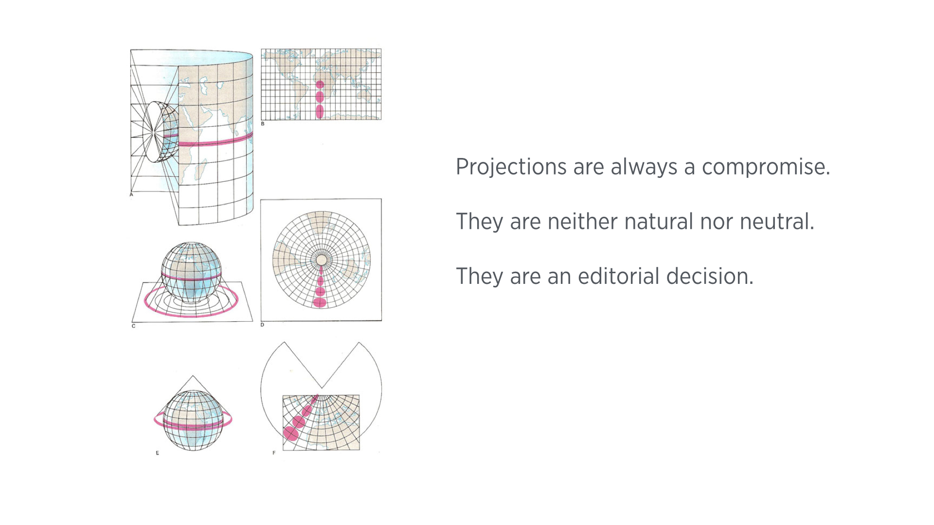
    One of the main things about maps is that they are essentially projections, in both senses of the words. A perfect projection does not exist, and the choice of a particular projection depends on what sort of information the map maker feels is most important for the context.
    cartopsychosis.004


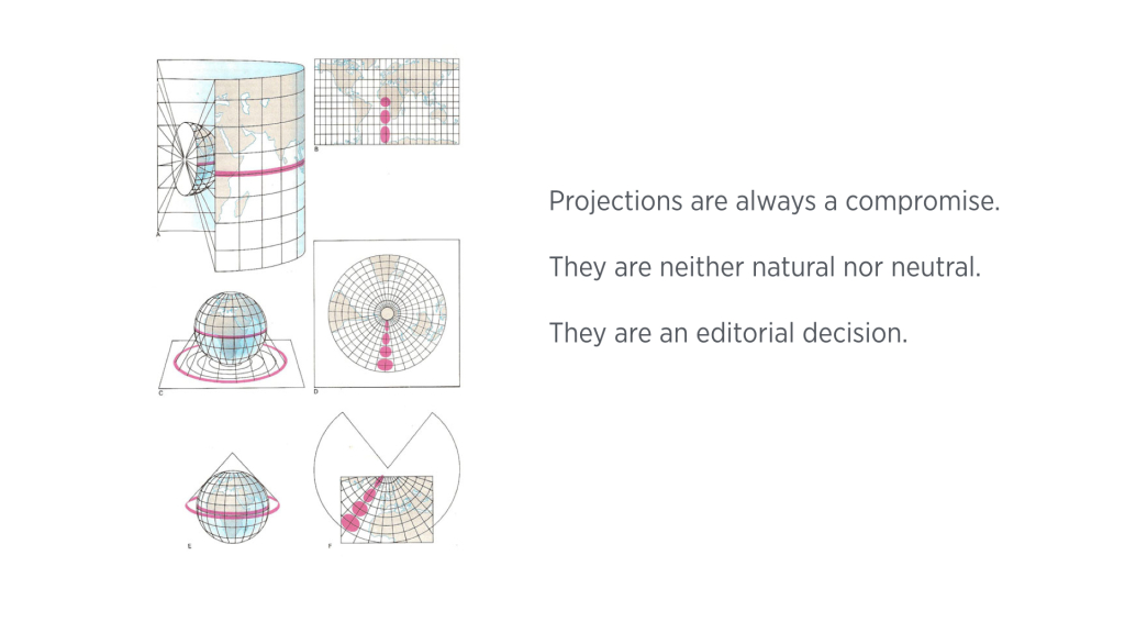
    For instance, the Mercator projection (uppermost diagram in the slide above), which is an equatorial, cylindrical projection, is accurate at the equator and gets distorted as you move towards the poles. Other projections can solve that at the expense of other information: Transverse Mercator is more accurate at the poles but completely removes a geographical point at the equator. There are also azimuthal and conic projections, like the ones illustrated in the middle and bottom of the slide above. While they are accurate at the polar areas, they distort all other areas, and/or introduce discontinuities to the topography. cartopsychosis.005

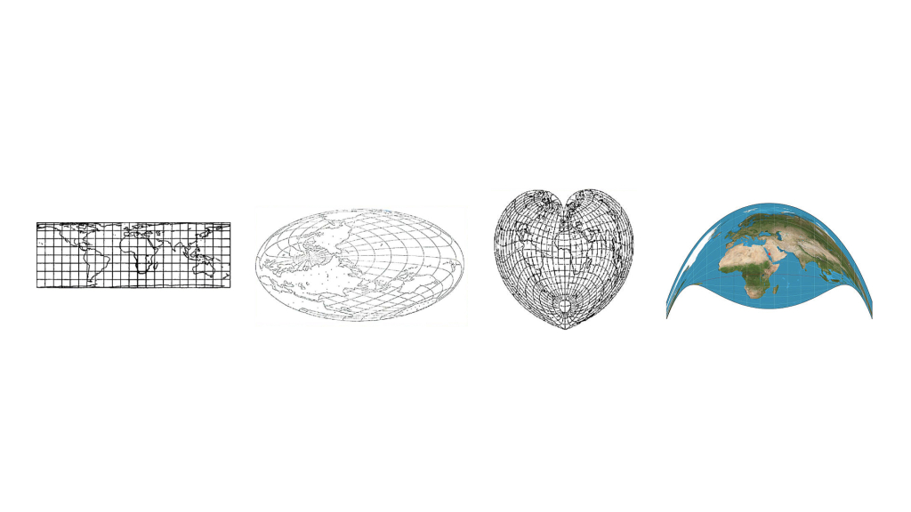
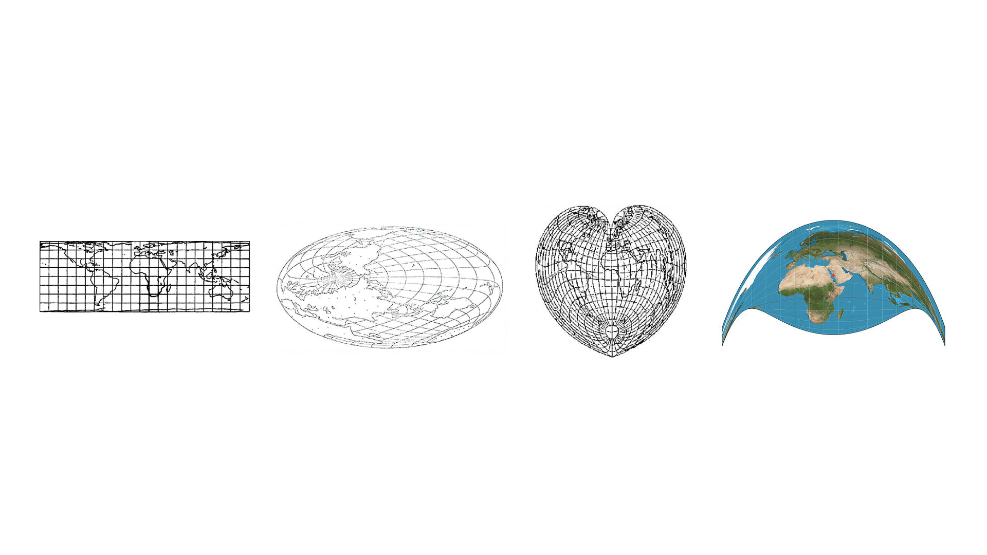
    (As an aside, projections are such a powerful device both visually and as a filter for spatial information. To begin with, not every projection is made for a standard rectangular-plane. The leftmost projection above is designed to be used with mobius-like surfaces. Both of the middle projections conserve the distance or area from the center of the map, and distort distances/areas that do not include the center of the map. The rightmost projection, called the Craig Retroazimuthal Projection, is used to center a map around a geographical point, and distorting all else, in this case the center is Mecca. I personally feel it is a strong way to make a political point.)
    cartopsychosis.006

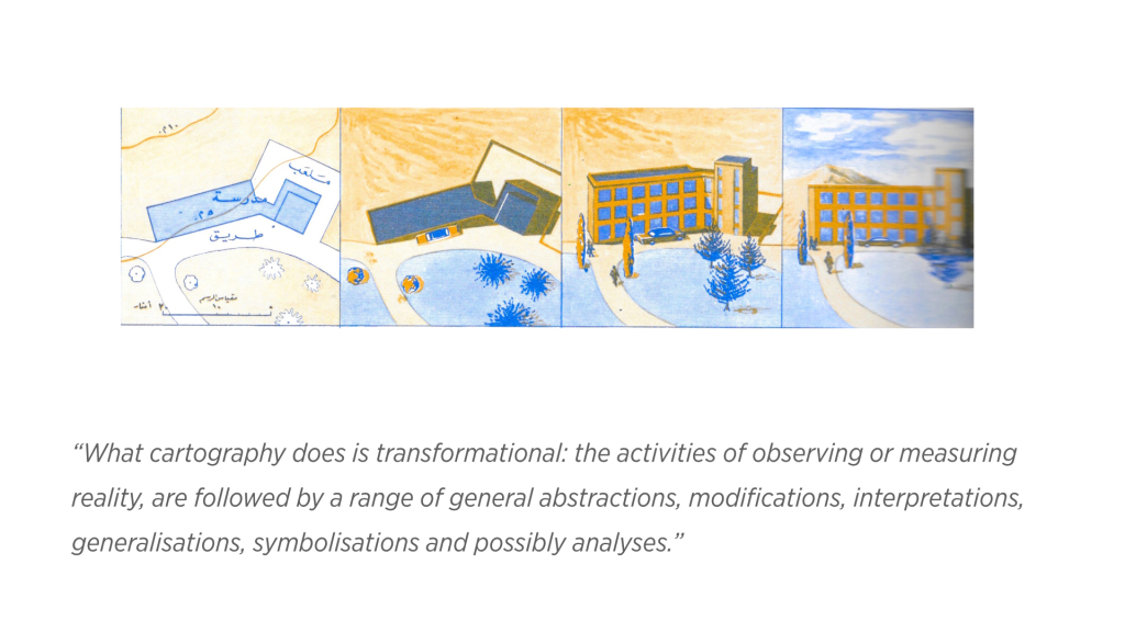
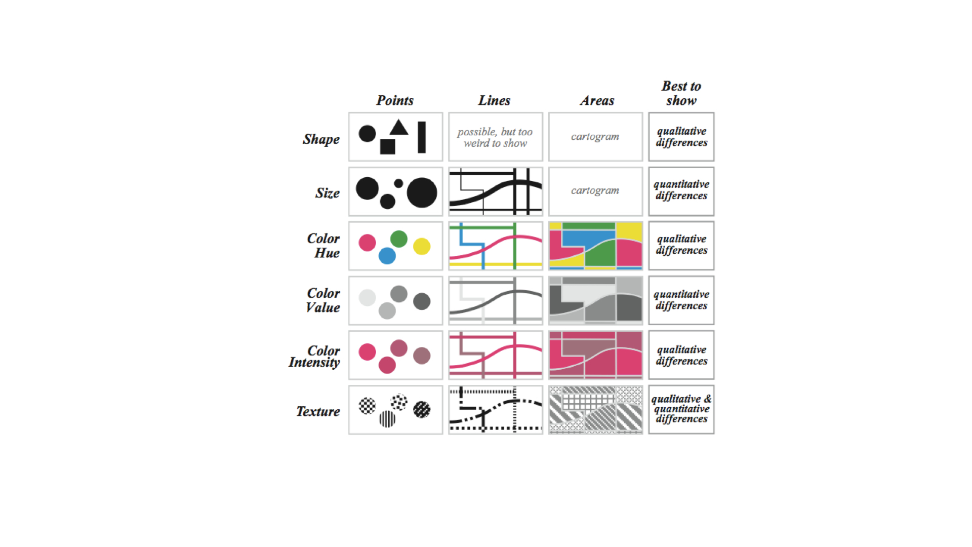
    It is not only the choice of projection method, there is also an extensive process of “symbolisation,” i.e. mapping visual symbols to spatial (and non-spatial) data inherent in mapmaking. This is the essence of the cartography process; the seminal work of French cartographer and theorist, Jacques Bertin, as seen below, has set the principles of this process extensively and articulately. cartopsychosis.007 cartopsychosis.008

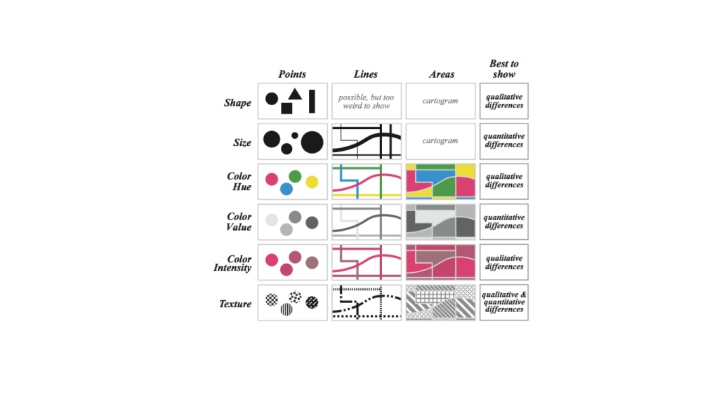
    Maps are a tremendously powerful thing. In a way, a map is a blueprint for wars, and a war is effectively a man-made change of geography.

    cartopsychosis.009

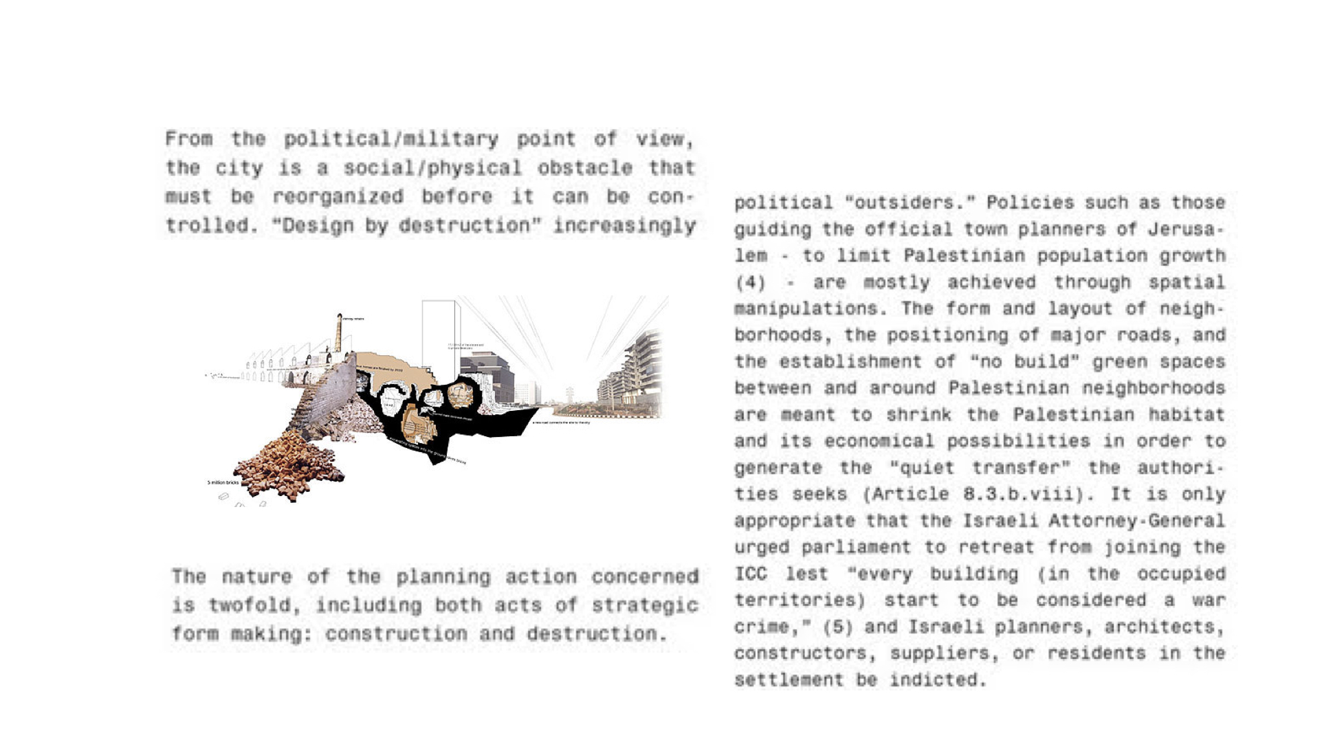
    Eyal Weizeman, notable Israeli architect and intellectual, goes as far as to argue that architects, and by extension, urban planners and cartographers, should be held equally accountable for some acts of war that involve “design by destruction.” The danger of their work is not only in the process of planning war efforts, but also in the way urban colonization is made concrete in the layouts of captive cities, in the spatial control of how materials flow to captured places. cartopsychosis.010 cartopsychosis.011

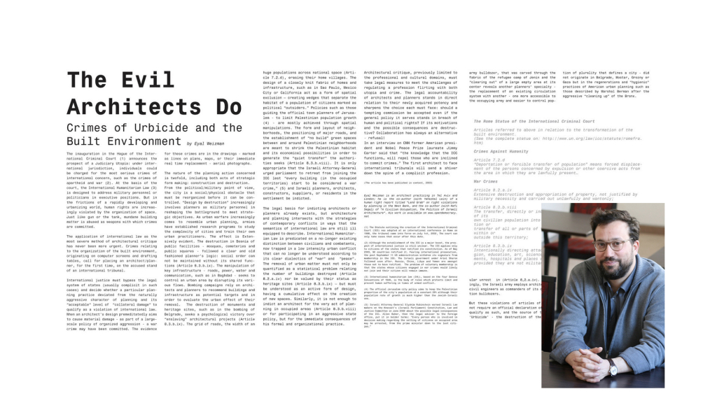
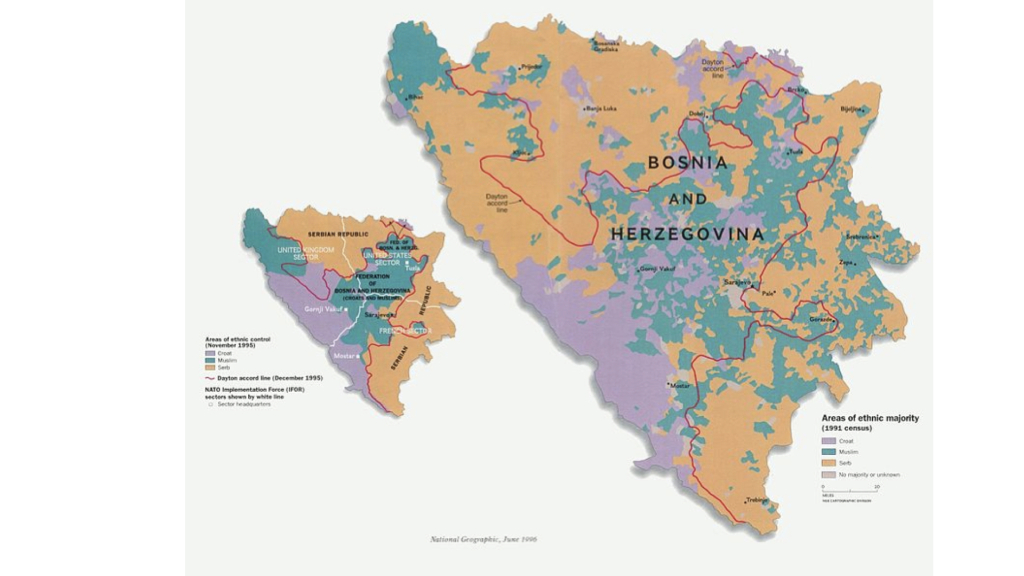
    A clear example of the way wars are a change of maps, is the reshaping of Bosnia and Herzegovina after the 1991 civil war. Before it, the ethnical markup was nebulous, and after it, the region fell into a neatly organized set of ethnically segregated areas.

    cartopsychosis.012

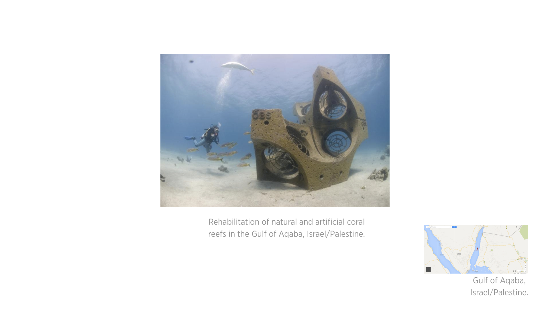
    Maps are also as much of a tool of resistance as they are for occupation. cartopsychosis.013 cartopsychosis.014

    cartopsychosis.015


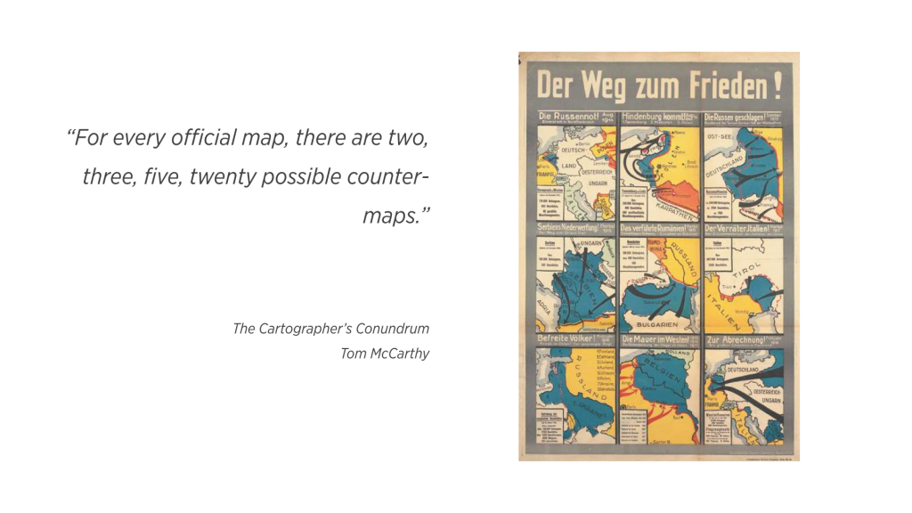
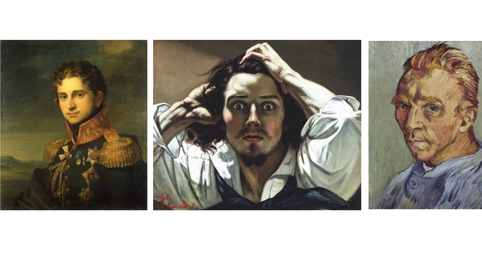
    One prevailing theory of the progression of art is that, after the Renaissance, works of art were made, generally speaking, to map the emotion of the subject matter to the art’s medium, and in a way, to elicit an emotional response in the audience. Ernst Gombrich argues that, by the end of the eighteenth century, artists were expected to map their state of emotions rather than that of the subject matter or the viewer. cartopsychosis.016 Cartography moved, and still does, in the opposite direction. Due to the limitation of technological means in primitive times, maps started as a subjective visual works that convey an impression more than information. Modern maps are more about information, but not completely about that. cartopsychosis.017
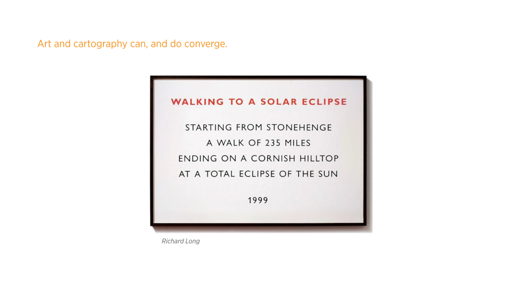
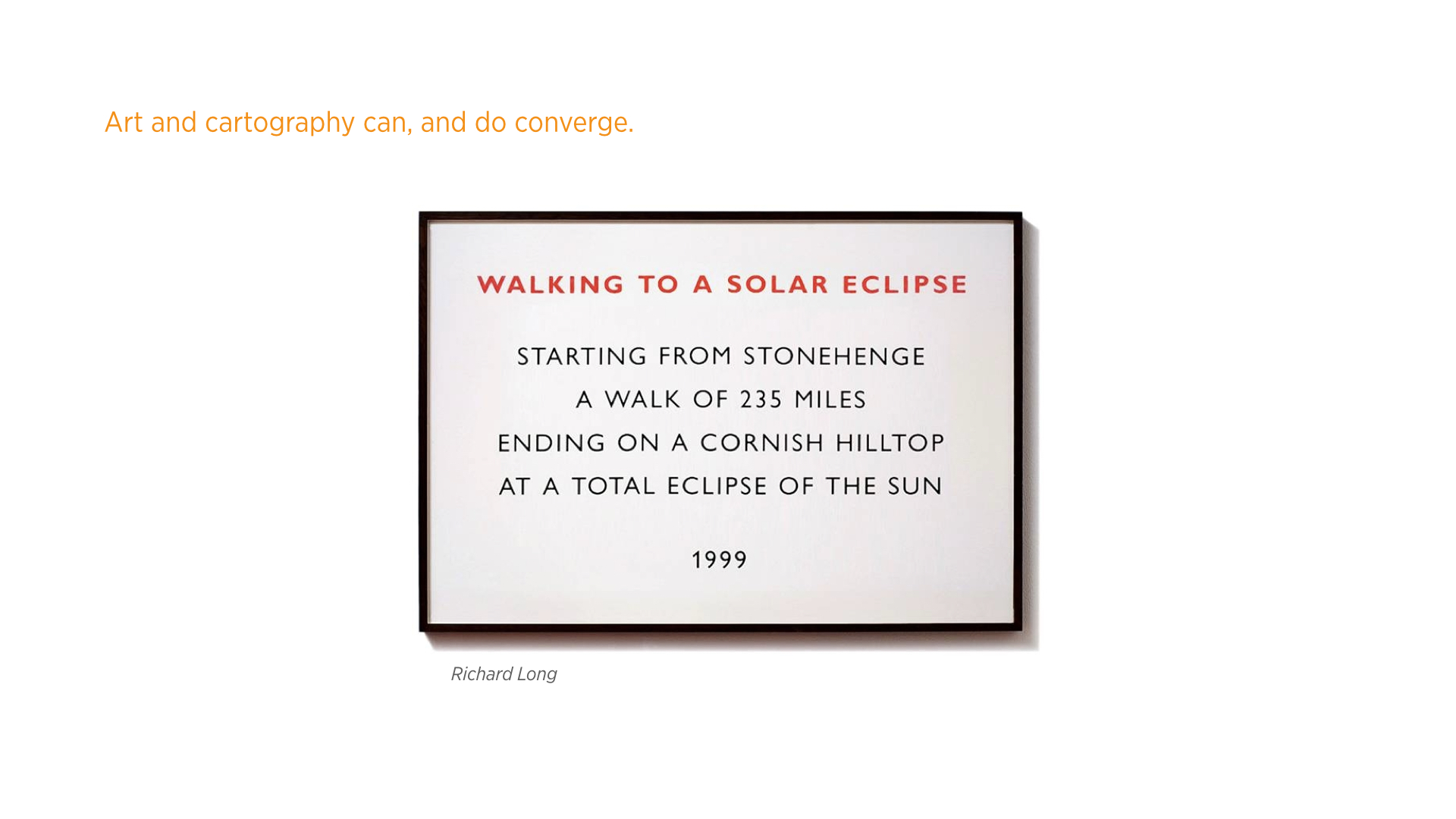
The point of the above is that cartography and art should not be necessarily considered too far removed from one another. Cartographic art, whether in the sense of “cartography-assisted performance art” as with the work of Richard Long, or maps that impress more than enlighten, is, in my personal opinion, as aesthetically and conceptually powerful as a painting.
    cartopsychosis.018 cartopsychosis.019 cartopsychosis.020

    The final thing of note in this line of thinking is the idea of space itself. Space has been defined and redefined in all philosophical manners throughout time, from the idea of space being relational, to the scientific idea of the convergence of time and space in the concept of spacetime. What is space anyway, and why should maps be about a single institutional idea of it?
    cartopsychosis.023LIST OF SOURCES, IMAGES, AND MORE:

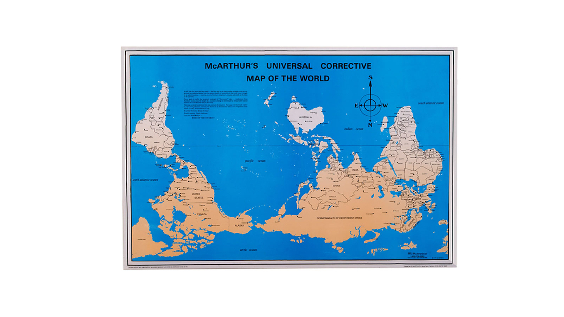
    Image: McArthur’s Universal Corrective Map of the World


    “Maps are broken..”:

    Ideas: The Mapmaker’s Conumdrum, Tom McCarthy, The New Yorker

    Ideas: Mapping It Out: An Alternative Atlas of Contemporary Cartographies, Hans Ulrich Obrist

    Image: Postcards from Google Earth , Clement Valla (color corrected by me to suit the color theme of the slideshow)

    Ideas: Cartography: Thematic Map Design, Borden Dent , Jeff Torguson , Thomas Hodler

    Image: The World’s of David Darling, David Darling

    Ideas + Images: Unusual Map Projections, Waldo Tobler

    Image: الأطلس العربي World Atlas (Arabic)

    Ideas + Image: Semiology of Graphics: Diagrams, Networks, Maps, Jacques Bertin


    “Maps are violent..”

    Ideas: The Mapmaker’s Conumdrum, Tom McCarthy, The New Yorker

    Quote: Cartography: Thematic Map Design, Borden Dent , Jeff Torguson , Thomas Hodler

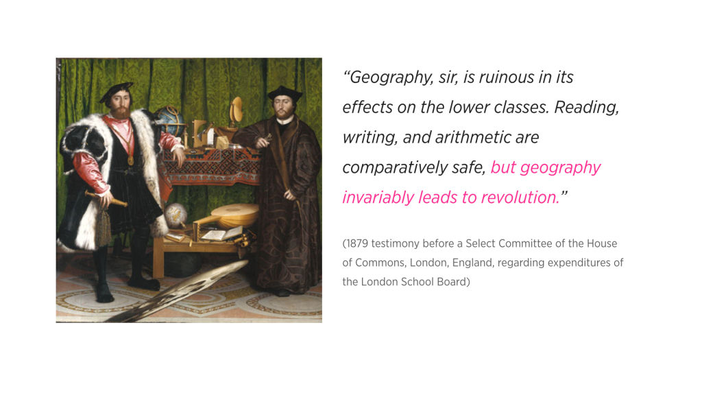
    Image: Hans Holbein’s The Ambassadors

    Ideas: The Evil Architects Do, Eyal Weizman

    Image: Faustian Urbanism, Manuel Herz, Eyal Weizman

    Image: Bosnian Census, Wikipedia

    Image: The Way to Peace! Nine maps of German campaigns from August 1914 to spring 1918.


    “A Map is not a painting..”

    Ideas: Rejecting Illusionism: Transforming Space into Maps and into ArtDavid Fairbairn, from Cartography and Art , edited by Cartwright, William, Gartner, Georg, Lehn, Antje

    Image: A Portrait by George Dawe 

    Image: Gustave Courbet self-portrait, “The Desperate Man”

    Image: Vincent van Gogh, Self-Portrait 

    Image: Richard Long’s Walks

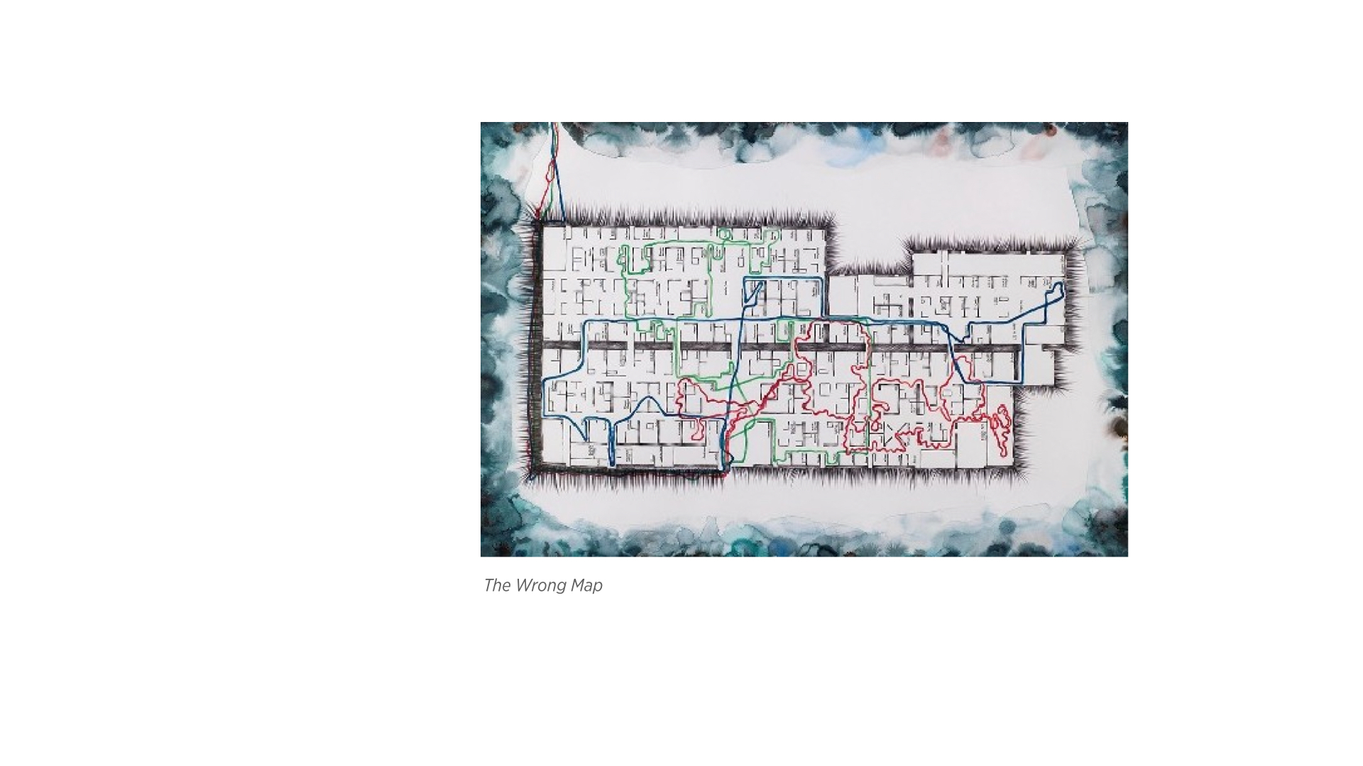
    Image: Night Shift/The Wrong Map 2004 by Adam Chodzko

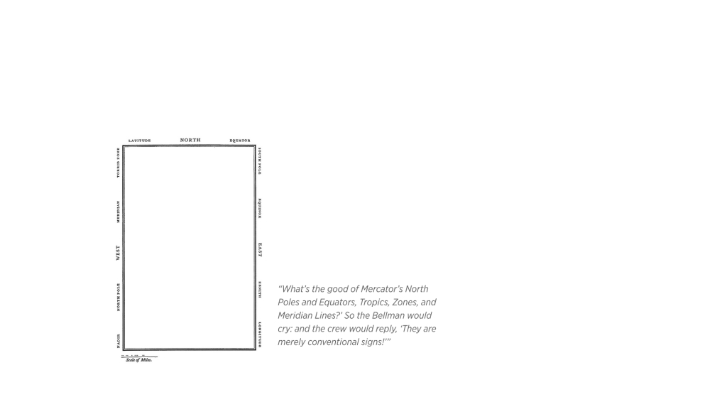
    Image: Oceanchart (from Lewis Carroll’s The Hunting of the Snark)


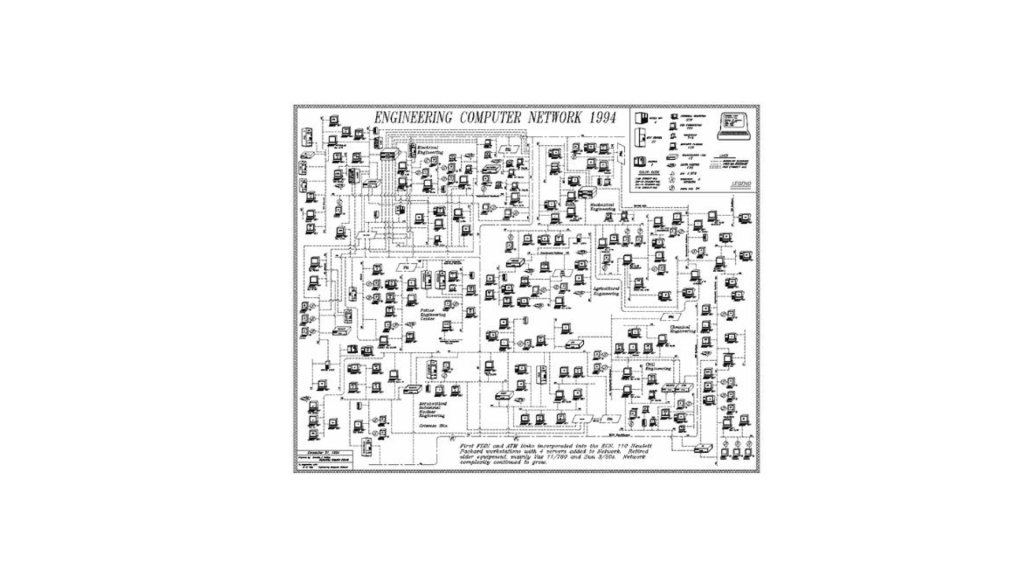
    Image: 1994 ECN Network Map


  • TEXTMAPS

    TEXTMAPS

    Inspired by Richard Long’s Textworks, and as part of my Temporary Expert research about maps that are not strictly geographical, maps that are not used as a reference, or ones with a non-pedagogic agenda, I started a daily exercise in the last couple of weeks to create “textmaps” that are more of cryptic, cheesy description of said maps.

  • The Shipwreck Song

    The Shipwreck Song

    This is a “song” (if you can stretch the definition of that far enough) that I had to write and “perform” (read: read) as part of my temporary expert research project on shipwrecks. I am including it here so that I can always find it if I am in the mood to feel awkward.

  • Shipwreck Society, presentation

    Shipwreck Society, presentation

    This is the presentation Eamon and I did for the findings of our joint research project about both Shipwrecks and Muriquis.


     Sources

    The call:

    Failure in conserving Muriquis + “It’s not just numbers, it’s dynamics.”:  

    The Power of Environmental Narratives

    Cod food web:

    “Ultimately art does not reside for me in the object. Art reside in what is said about the object.”:  

    Biomorphic art:

    Pathology in Evolution:

    The concept of a shipwreck society:

    Homogeneity is bad:

    Ecology and Realist Ontology:

    Umwelt:

  • Shipwreck Society, research summary

    Eamon, my partner in research, and I, have been thinking deeply about our joint research project about both shipwrecks (yay) and Muriquis, a particularly interesting semi-extinct species of monkeys.

    Because it’s been a collaborative effort, we have our notes in a google doc for your voyeuristic pleasure. (Only viewable if you have an NYU email address.)


  • A Call for Shipwrecks

    A Call for Shipwrecks


    THE CALL

    temp-expert-presentation-1.002

    temp-expert-presentation-1.003

    RESEARCH FINDINGS

    I.
    temp-expert-presentation-1.004

    temp-expert-presentation-1.005

    temp-expert-presentation-1.006

    temp-expert-presentation-1.007


    II.
    temp-expert-presentation-1.008

    temp-expert-presentation-1.009

    temp-expert-presentation-1.010

    temp-expert-presentation-1.011


    III.temp-expert-presentation-1.012

    temp-expert-presentation-1.013

    temp-expert-presentation-1.014

    temp-expert-presentation-1.015

    IV.

    temp-expert-presentation-1.016

    temp-expert-presentation-1.018

    temp-expert-presentation-1.019

    temp-expert-presentation-1.020

    THE PROPOSAL

    temp-expert-presentation-1.021

    temp-expert-presentation-1.022

    temp-expert-presentation-1.023

    temp-expert-presentation-1.024

    THERE IS ALWAYS MORE

    temp-expert-presentation-1.025

  • Reefs are grownup shipwrecks

    Reefs are grownup shipwrecks

    This is a summary post that serves as a snapshoot for the interesting things I recently learned through my research of the subject of Shipwrecks, as part of the Temporary Expert class.

    Reefs are grownup shipwrecks

    1. Shipwrecks are accidental shelters for marine life. Predators and sedimentation are things that inhibit the growth and sprawl of smaller sea creatures that live on the ocean floor, which makes a change of the topographical quality of the ocean floor a welcome thing to its ecological system.

    2. A beautiful example of this is the CondoFish project that was an accidental result of a the sinking of an anchored Mexican ship in the mid 1980s in the Playa Hermosa region in Costa Rica.

    3. The ship sunk in shallow waters, and upon its discovery in 2002, the southern part of it, where ropes and nets were kept, was found to be completely covered by corals, small fish, and vegetation.

    4. As a result, the CondoFish project came to being where efforts were made to design, test, and deploy artificial reefs in the (recreational divers abound) coast to both save and encourage marine life there.

    Not all reefs are made equal

    5. One endangered species that is greatly benefitting from the structural properties of sunken ships is oysters. Their environmental value lies in their agency in consuming excess nutrient in the ocean floor, recycling them in some cases.

    6. A study was conducted to find the optimum reef configuration to induce both a sustainable growth in an oyster community, as well as survival against predators, compared the effects of four arrangements according to their vertical-horizontal orientation, and whether they contain a shelter or not.

    7. The advantage of a horizontal arrangement in an artificial reef is that it increases the chance of contact between abandoned oyster shells, and young larvae that seek to settle and grow in a reef. (Oysters generally nest on shells that are abandoned and they gradually make their own.)

    8. However, in times of high sedimentation, a horizontal arrangement has the major disadvantage of lowering the number of growing oysters as the sediments can effectively kill the larvae.

    9. Therefore, a vertical arrangement is superior in times of high sediment, even if the level of contact is decreased. This was proved by the study’s empirical results.

    10. In terms of the effects of having a shelter in the structure of the reef, empirical results found that the number of settled oysters in arrangements with shelters is noticeably less than cases without. However, with the presence of predators, the percentage of surviving species is much higher than shelter-free reef arrangements.

    11. Therefore, taking both the size of the communities within reefs as well as the percentage of surviving oysters in cases of predators and high sedimentation, vertical reef structures that contain sheltering alcoves are the best arrangement for oysters to prosper.

    Please save our oysters

    12. There has been a number of cases of catastrophic loss of oysters population as well as corresponding efforts to correct them.

    13. Locally, the NY-NJ Harbor Estuary lost a great deal of its (once famously abundant) oyster population to water pollution, overfishing, and disease.

    14. One major effort was the NY-NJ Harbor’s studies conducted between 2010 to 2013 to deploy and monitor a number of artificial reefs in a number of locations to assess the feasibility of a major restoration effort.

    15. Another catastrophe is the almost complete depletion of the (reportedly delicious) Olympian oysters in the Bay area, specifically Tomales Bay.

    16. This time the culprit is global warming: the increase of CO2 in the water results in increased acidity that effectively eat into the shells, making them more fragile and their oysters vulnerable to predators and sedimentation.

    17. Another effort I am currently investigating is one in Al-Aqaba gulf in Palestine/Israel.

    Reefs are art too

    18. There seem to be an interesting pattern in the field of environmental art where artists are making meaningful work by creating artificial reefs.

    19. One of the most inspiring instances is the work of Jason deCaires Taylor, who made a series of surreally beautiful statues that are not only aesthetically pleasing, but environmentally conductive in two ways!

    20. The statues have the obvious value as artificial reefs (for corals mostly), but they also serve as a distraction for the recreational divers from existing, natural reefs.

    21. (The statues have also the communal value of being made from using persons from the fisherman village around the community in the sculpture casting process.)

    22. Another local project is the Oyster-tecture project (currently invasatigating).

    23. Also, the Manahatta project which even comes with its own curriculum of activties for kids that I hope to follow.

    24. An amazing, local artist who I am hoping to meet soon is Colleen Flanigan. Her underwater work even includes electrical components (!!).

    There is always more

    25. And don’t get me started with the aesthetics of coral reefs…

    26. There is an Instructable for everything, including How To Make Your Own Artificial Reef (courtesy of the CondoFish guys mentioned above).

    27. There are vertical ships too!

    (Photo on top is Jason deCaires Taylor’s Viccisitudes Sculptures. [I don’t own the rights to this photo. I’m only an overworked student, please don’t sue me!])

  • Operating On The Concept of Shipwrecks

    Operating On The Concept of Shipwrecks

    Inspired by Marina’s conceptual research operations (Analogy, metonymy, conflation, juxtaposition, amplification, exaggeration, speculation, mimicry, false methology, and the absurd), I decided to document the results of my asking the operational questions on the subject of shipwrecks as I progress in my research.

    The below is the google doc I am using to track my answers to said question. Scroll horizontally to view all the entries.

  • Making A Coral-inspired Object

    Making A Coral-inspired Object

    As I have been heavily researching coral reefs as part of my Temporary Expert research project, I decided to make an object that incorporates the aesthetics of coral somehow.

    The parameter of the project in the context of the Intro to Fabrication class is to use the laser cutter. Design for a laser cutter is ideally vector-based, and heavy with either itching or cutouts. I decided to go with the latter, and to use acrylics as they provide enough color choices to allow for an interesting design.

    The idea I felt most attracted towards is to play with the overlay of coral-inspired patterns. To showcase that, the best approach is to have two or more parts, each with a different cutout design (or the same design but with a different scale and/or orientation), that are within one another. This allows for a mismatch of patterns that, I hope, will result in an interesting look.

    I decided that the design will be made of two cubes of different sizes, with one placed within another.

    Processed with VSCOcam with f2 preset

    In terms of the pattern design, as I previously mentioned, I wanted it to be coral-inspired. I collected suitable vector files, and ended up with choosing to work with the following group of images as a source.

    vectorstock_1361503

    Before proceeding with the acrylic process, I wanted to make sure of the interstingness of the concept of the pattern overlay. I have a vinyl cutter handy at home, so I decided to cut a paper-based design for verification.

    Processed with VSCOcam with b6 preset

    Processed with VSCOcam with m5 preset

    After a period of experimentation with various coral-like patterns, including a detour into stags (see image above), I opted to go with a less intricate pattern with holes of varying shapes and sizes. This is because they allow for far more interesting interaction of shapes.

    Screen Shot 2014-09-24 at 9.42.15 PM

    I’ve also opted to go with a circular design instead of the initial box design. Part of it is the time restrictions, another is the amount of acrylics I have for this project.

    The below are some of the pieces I cut to be used for the final design. They include colorful, transparent paper circles I cut using the vinyl cutter to be placed between the acrylic circles for visual effect.
    Processed with VSCOcam with f3 preset

    I ended up with two pieces, one where the predominant color is white, and another with yellow. The white one, before gluing, is on the top of this post.

    Processed with VSCOcam with f2 preset