(This is in relation to my ongoing Online Wayfinding System project.)
To simplify my work, I have to internally agree on a taxonomy of discrete elements that constitute the system I have in mind. For a wayfinding system, the first set of concepts that needs to be made concrete is the features of the geography. As I am basically making up a geographical representation for a space that does not really exist, I chose to think about and borrow from the basic elements of traversal that we come across every day.
I also chose to translate them into a tileable, iconographic system (static at the moment, I made its elements in Illustrator).
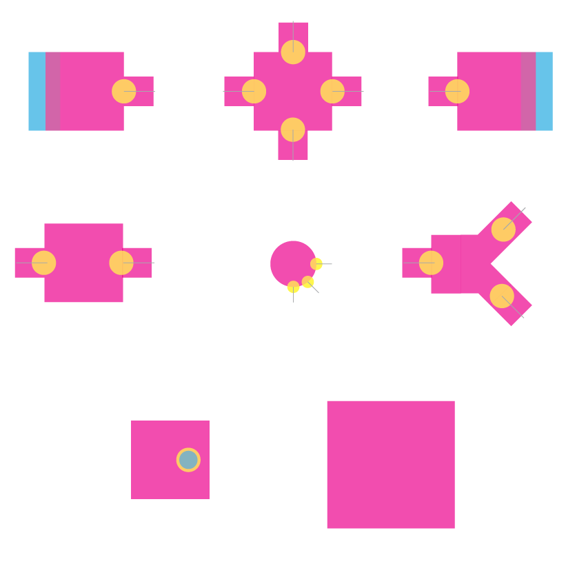
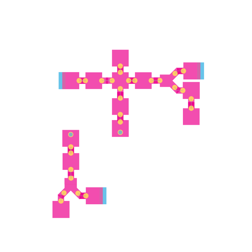
Obviously, a system of space needs two terminal points: an entrance and an exit. They are visually represented as the top left tile and the top right tile, respectively. A path between the entrance is typically a mixture between spaces that serve nothing but progress to a destination, as well as tiles that serve as controllers of directional flow: forks, and intersections.
An intersection, as I see it, is a tile that allows change into 3 or more possible alternative spatial sequences. I present them visually as the top middle tile. However, they generally occur less frequently than forks. A fork is a binary choice of one of two possible sequences. They are represented as the rightmost icon in the second row in the illustration above.
Taking the idea of an intersection into the extreme, we get the concept of hubs. A hub is a space that serves nothing except control the flow to one of many possibilities. As a concrete example in relation to my online wayfinding system, a search results page (e.g. what you get after entering “fruits” to Google’s search field), has no inherent value except for its aggregation of links. Such a page is simply a hub: you only go there to go to one of many places. In the diagram above. The hub is presented as the circular icon in the middle of the second row.
Another control flow element, as I presented in my previous design considerations post, is a teleport room. In their simplest term, they allow the user to travel from one collection of contiguous locations to another instantaneously, allowing the linkage between regions and sessions. They are, in effect, a tool to manage the increasing complexity of a growing map. They are represented above as the square on the left at bottom row in the illustration above. Note the circular blue/yellow element within that represents the teleporting point.
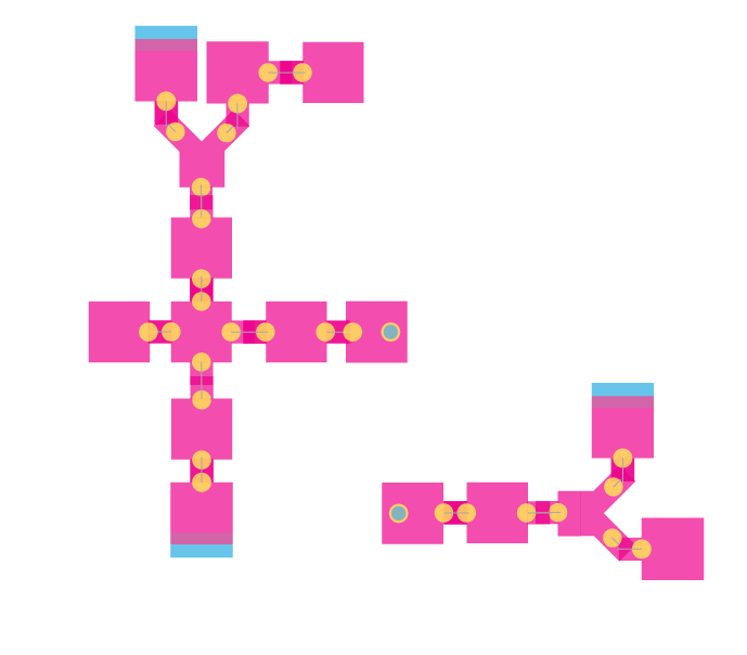
Connecting the tiles together allows for orderly, rational spatial paths to appear, as in the example above. However, to me, they are useful for tracking sequences, but are they as memorable as, say, a map a specific street? This is what I would like to think about more in the next few days.
(Also, behold, my very first Chrome extension.)

Leave a Reply